
INCOIS Deploys New Tech to Track Kerala’s “Kallakkadal” Surges
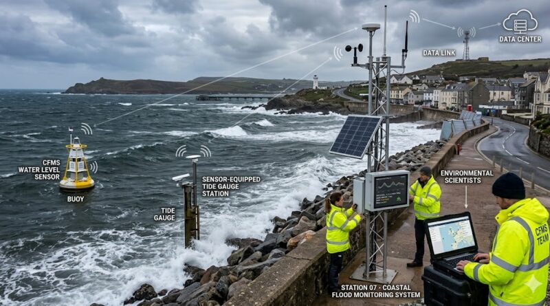
The southwest coast of India is getting a high-tech shield against the “stealthy” dangers of the deep. The Indian National Centre for Ocean Information Services (INCOIS) has announced the installation of its second Coastal Flood Monitoring System (CFMS) near the Kollam harbour in Kerala.
This expansion aims to provide more accurate warnings for Kallakkadal—sudden, high-energy swell surges that can devastate fishing villages and coastal infrastructure without any local weather warning.
What is “Kallakkadal”?
Derived from the Malayalam words for “sea that comes stealthily,” Kallakkadal events are particularly dangerous because they occur during seemingly calm local conditions. Unlike storm surges caused by local cyclones, these are:
- Triggered by Distant Storms: Generated by atmospheric disturbances in the Southern Indian Ocean, nearly 10,000 kilometres away.
- Invisible to the Eye: These long-period swells travel across the ocean for days before intensifying as they reach India’s shallow coastal waters.
- Sudden Inundation: They can raise water levels significantly in a matter of minutes, catching coastal communities entirely off guard.
The Tech Behind the CFMS
The new system in Kollam isn’t just a simple tide gauge. It is an integrated monitoring powerhouse designed to capture the complex physics of swell waves:
- High-Frequency Sensors: Four pressure sensors are installed in shallow waters at depths of 3 to 7 metres.
- Weather Integration: Each unit features a coastal automatic weather station to cross-reference ocean data with local atmospheric conditions.
- Micro-Wave Analysis: The system tracks swells with periods ranging from 30 to 300 seconds, allowing scientists to see exactly how energy builds as it hits the shore.
“The aim is to identify patterns in southern ocean swells and refine forecasting models for improved accuracy,” said T.M. Balakrishnan Nair, Director of INCOIS.
Why Kollam?
Following the success of the first CFMS deployment at Vizhinjam last year, Kollam was identified as a critical “hotspot.” The region’s specific coastal bathymetry (the shape of the underwater floor) makes it particularly vulnerable to the shoaling effect—where waves grow taller and more dangerous as they move from deep to shallow water.
By comparing data from both Vizhinjam and Kollam, INCOIS scientists hope to build a regional “fingerprint” of how these waves transform, ultimately leading to an early warning system that gives fishermen and residents a crucial head start.
A Step Toward Coastal Resilience
This move is part of a larger effort by the Ministry of Earth Sciences to bolster India’s disaster management capabilities. With better data, authorities can now issue more precise, localized alerts, ensuring that the “stealthy sea” is no longer a surprise to those who live and work on the front lines of the coast.